The BlueChart Atlantic includes coverage for several offshore regions — select one of these regions to view and download charts with this purchase. See the product compatibility table (right) for a list of products that Garmin recommends with this software.
BlueChart Atalantic feature include:
* coverage for Lake Helgasjön in Sweden.
* includes Finland Port Services.
* Editions and notices to mariner changes
* Coverage of additional Hydrographica (Sweden) lake charts including Lake Bolmen, Storsjon and Sommen
* Includes Boatlaunch UK Slipways and S57 data for Latvia and Estonia
* Coverage of Africa, Europe and the Middle East
* Local charts for most countries using UKHO S57 data and high level Hydrographica, Sweden charts
* Port services for the U.K., Ireland, Norway, Sweden, Denmark, Netherlands, France, Portugal, Spain, Italy and Croatia in cooperation with Bloc Marine, REEDS Nautical Almanac and other local vendors
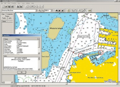
* Chart-specific information, including chart name, number, scale, revision date, latest Notice to Mariners date
* Trip and waypoint management function lets you transfer waypoints, routes and tracks between your GPS and your PC
* Faithful representation of published official paper charts
* Object-oriented cartography
* Shaded depth contours
* Intertidal zones
* Spot soundings
* Port plans
* Navaids with view range and coverage
* Tides, wrecks, restricted areas and anchorages
Comments